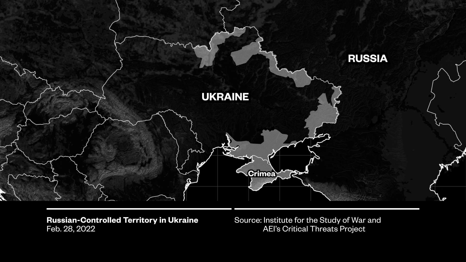
Mapping Ukraine
Animated maps tracking shifting battle-lines, troop movements, and offensives in Ukraine using real mapping data from GEOLayers.
“Putin's War: A Vice News Special Report”
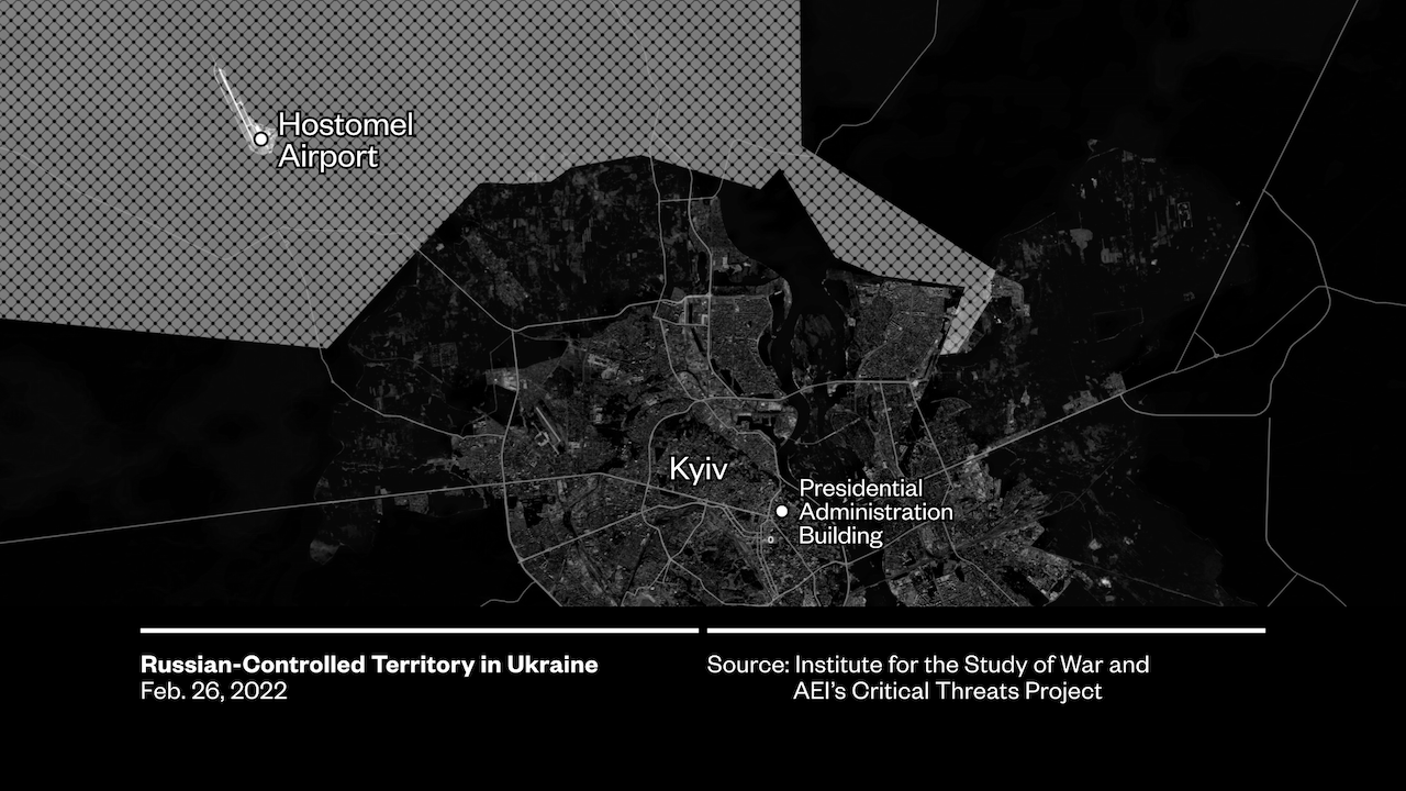
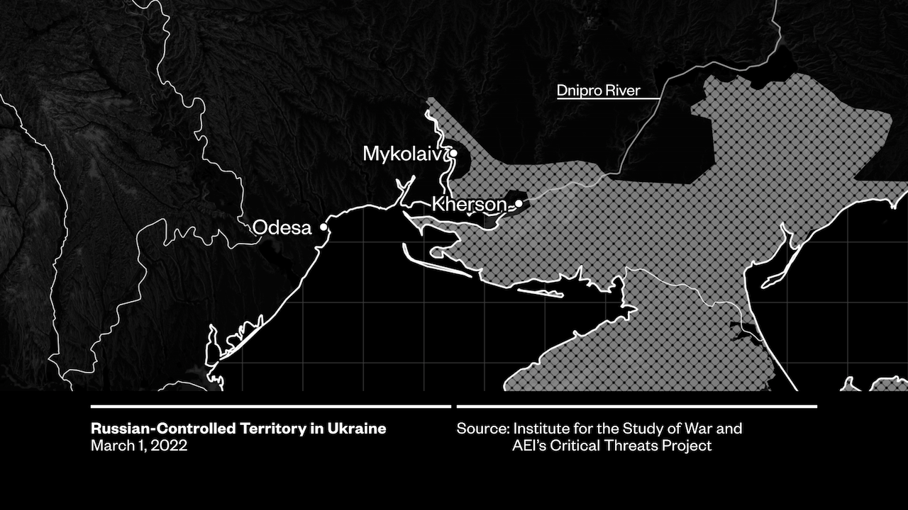
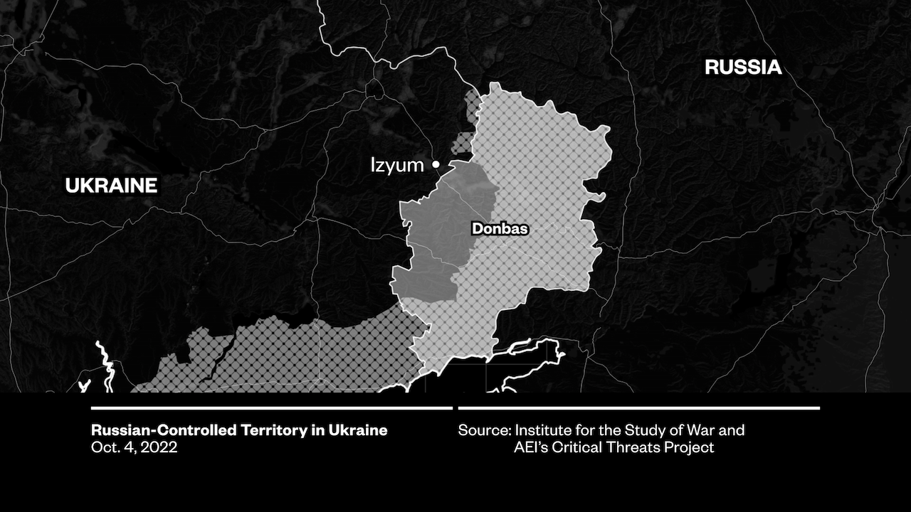
Map data source: Institute for the Study of War and AEl's Critical Threats Project.